
SKIATHOS Offline Hiking Map
by Nakas Road Cartography
Version 50+
📅 Updated Eligible if bought after 7/2/2016.
Learn
The absolute offline field guide for Skiathos island
Features SKIATHOS Offline Hiking Map
The application Skiathos Offline Hiking Map is a pure offline digital field guide for Skiathos Island.
The application is part of Offline Mapping Project of the Nakas Road Cartography, a company member of Nakas Group.
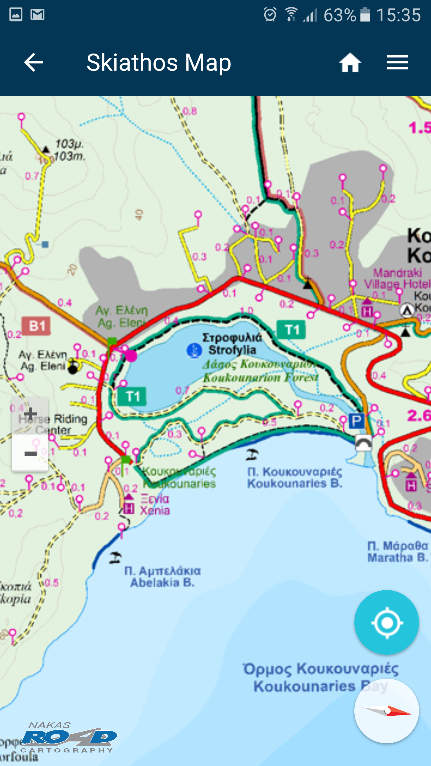
The Offline Mapping Project is the implementation of the Co-Creative team’s Vision to develop a comprehensive set of autonomous digital field guides in accordance with the requirements of its user community.The app contains high resolution digital maps with five zoom levels (1: 250.000 – 1: 15,000), compressed to 35.6 ΜΒ.
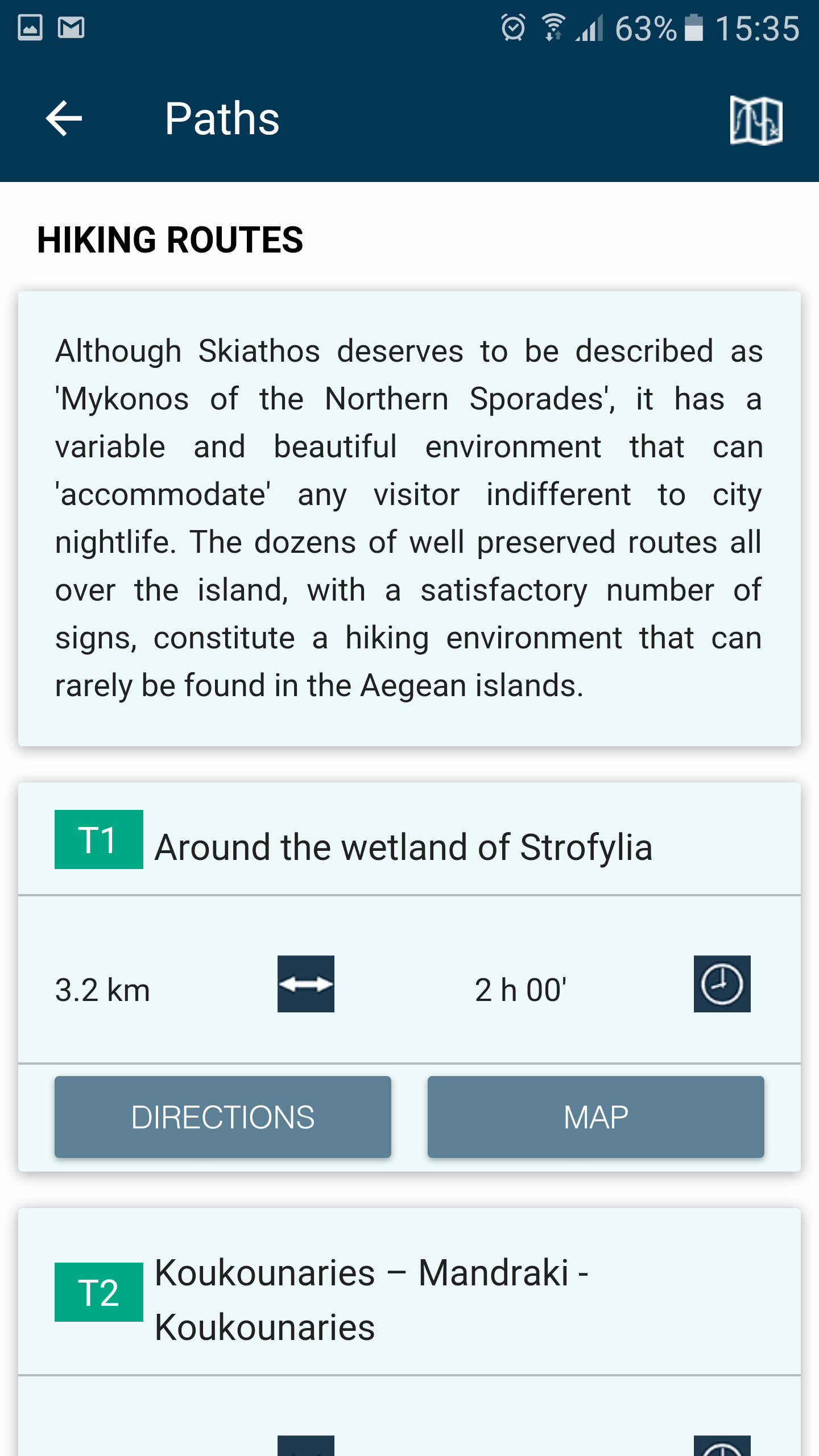
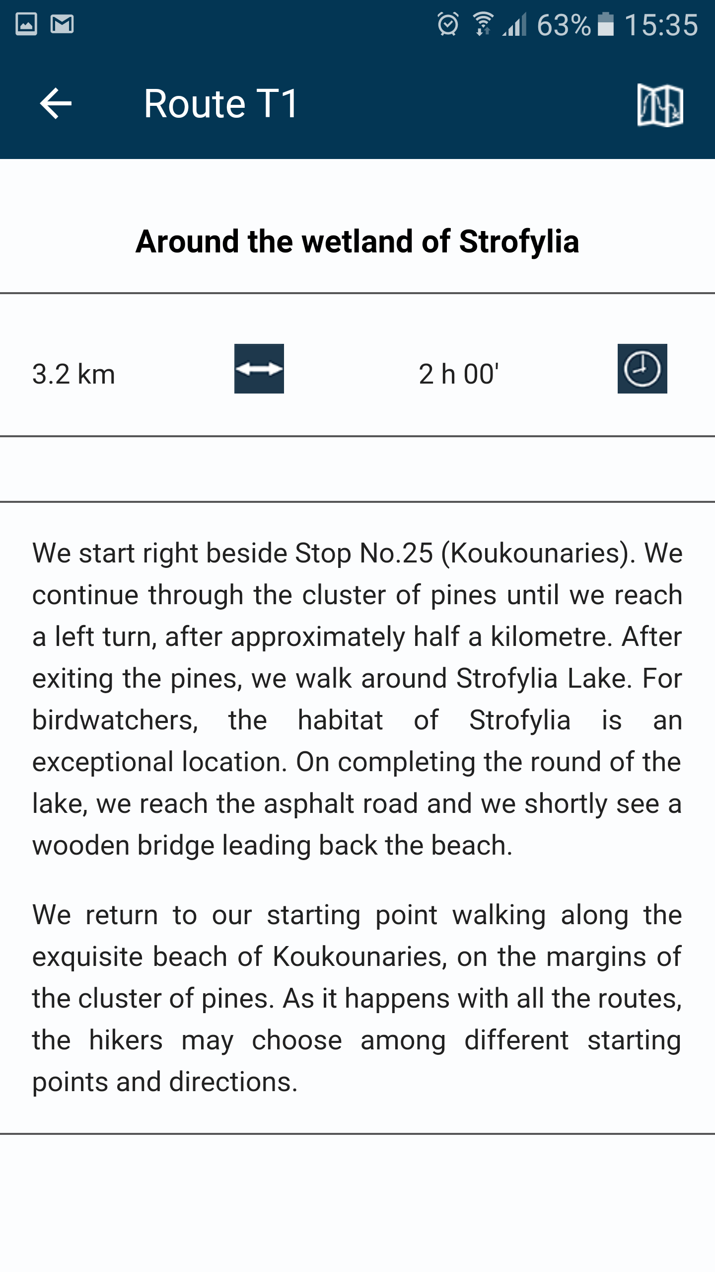
Also, contains a detailed description of 18 trails of Skiathos Island and compass functionality.
When the user is in the field, the application provides the user with contextual information with instructions, based on criteria of location (device GPS) and its direction.
Moreover, the application informs the user about the destination’s distance and the estimated time of arrival.
Fitness Tracking
Track your workouts and monitor your health metrics.
Travel Features
Plan and manage your travels with ease.
Food & Dining
Discover recipes and order food from your favorite restaurants.
See the SKIATHOS Offline Hiking Map in Action
Get the App Today
Available for Android 8.0 and above